Fields, Eriskay (page 89)
[I had been unable to locate the exact shooting location of this image on my first visit in 2016, but I had better luck a year later: see the addition at the end of this entry]
This was another landscape image that I could locate only approximately in 2016, and despite spending a long time climbing and criss-crossing the rocky hillside I was unable to find the precise shooting spot. A dark patchwork of fields and fences fills the lower two thirds of the image, with a rocky knoll rising to the left, a dwelling and shed to the right, rocky reefs exposed by the tide, and the islands of Lingay and (probably) Fuday towards the high horizon.
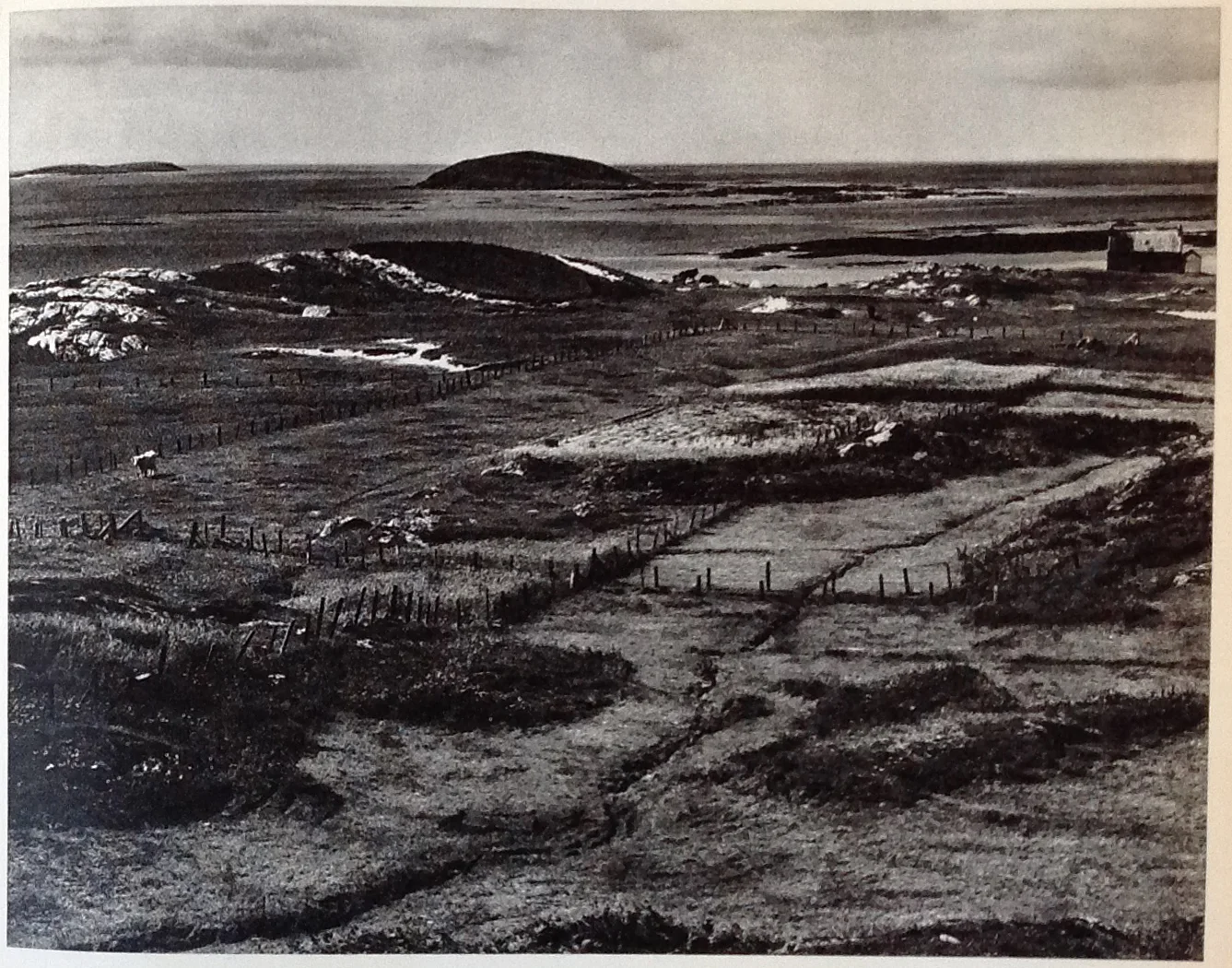
The road that gives the correct perspective on the foreground runs north between Coilleag and Am Baile, down past an enclosure with a statue of the Virgin Mary and in to an area of scattered mainly modern crofts amid rocky outcrops.
I suspect Strand's tripod was erected on one of these huge rocks on the east side of the road, but there has been a lot of building in the foreground, the fences no longer exist and a new cemetery has been built close to the sea. I could not identify the dwelling and shed on the right hand side of Strand's image, nor find a location that gave the same layout of rocks close to the shore.
The best I can offer is facing almost due west somewhere close to grid reference 788113. I have decided to leave the telephone wires in.
While scrambling around in this area the owner of a modern croft close to the road came out to find what I was up to. Carrying iPad, notebook and pencil, and camera, it wasn't surprising that at first he thought I was from the Crofting Commission ( http://www.crofting.scotland.gov.uk/crofting ).
My B&B host later gave me some background on the sometimes strained relationships among the Commission and the crofters, and this explained why the local became much more relaxed and friendly once I had described my real mission! He had never heard of Paul Strand, and couldn't help me better localise the image I showed him on my iPad.
UPDATE MAY, 2017
After landing at the Eriskay pier from Barra and collecting my Toyota hire car, I drove north, heading for lunch at the Am Politician. I kept an eye out west, trying to find a more accurate location for the image on page 89, and immediately after rounding a right hand bend and as the enclosure of the statue of the Virgin Mary came in to view, I realised I had found the correct spot as the various elements of the scene came together.
Fields, Eriskay. Mark Farrington, 2017
This is several hundred yards south and somewhat higher than the place I had settled on a year before, and on the west rather than the east side of the road - I remember trying up here then, but at the time it seemed wrong. Clearly, however the islands, rocky bluff, building, fences and stream are correctly related from up here, although there have been some alterations to the dwelling by the sea and to some of the grassy and scrubby banks. Despite criss-crossing the slope that runs down from the road I couldn't get a precise line-up of all the various elements. However, I must be within 25m of Strand's tripod.
The revised grid reference is roughly 787107, and my image below shows the orientation of my car (very close to the image location), the statue enclosure below and the town of Rubha Ban with the hills of South Uist beyond.
I enjoyed my lunch later at Am Politician, and the barmaid showed me a couple of the Polly whiskey bottles illicitly salvaged from the wreck of SS Politician in 1941 and made famous by Compton Mackenzie's book and the 1949 monochrome Ealing film comedy 'Whisky Galore'. The film has just been remade, and while most of the original was shot on Barra, the new version was sadly filmed far away on location in Aberdeenshire...
Presumably the cutlass comes in handy late on a Friday night.
Some links to details of the SS Politician story and the films:
http://www.scotlandspubsandbars.co.uk/location/am-politician/
https://en.wikipedia.org/wiki/SS_Politician
https://www.pressreader.com/uk/scottish-daily-mail/20170327/281994672321635
https://scotchwhisky.com/magazine/features/8384/the-true-story-behind-whisky-galore/