Paul Strand’s large image spreads across pages 66 and 67 of Tir A' Mhurain and parallels the human form, with the rocky outcrops crowning Beinn Mhor and Beinn Choradail symmetrically framing the view over the gentle rise of Maola Breac at the north-western side of South Uist.
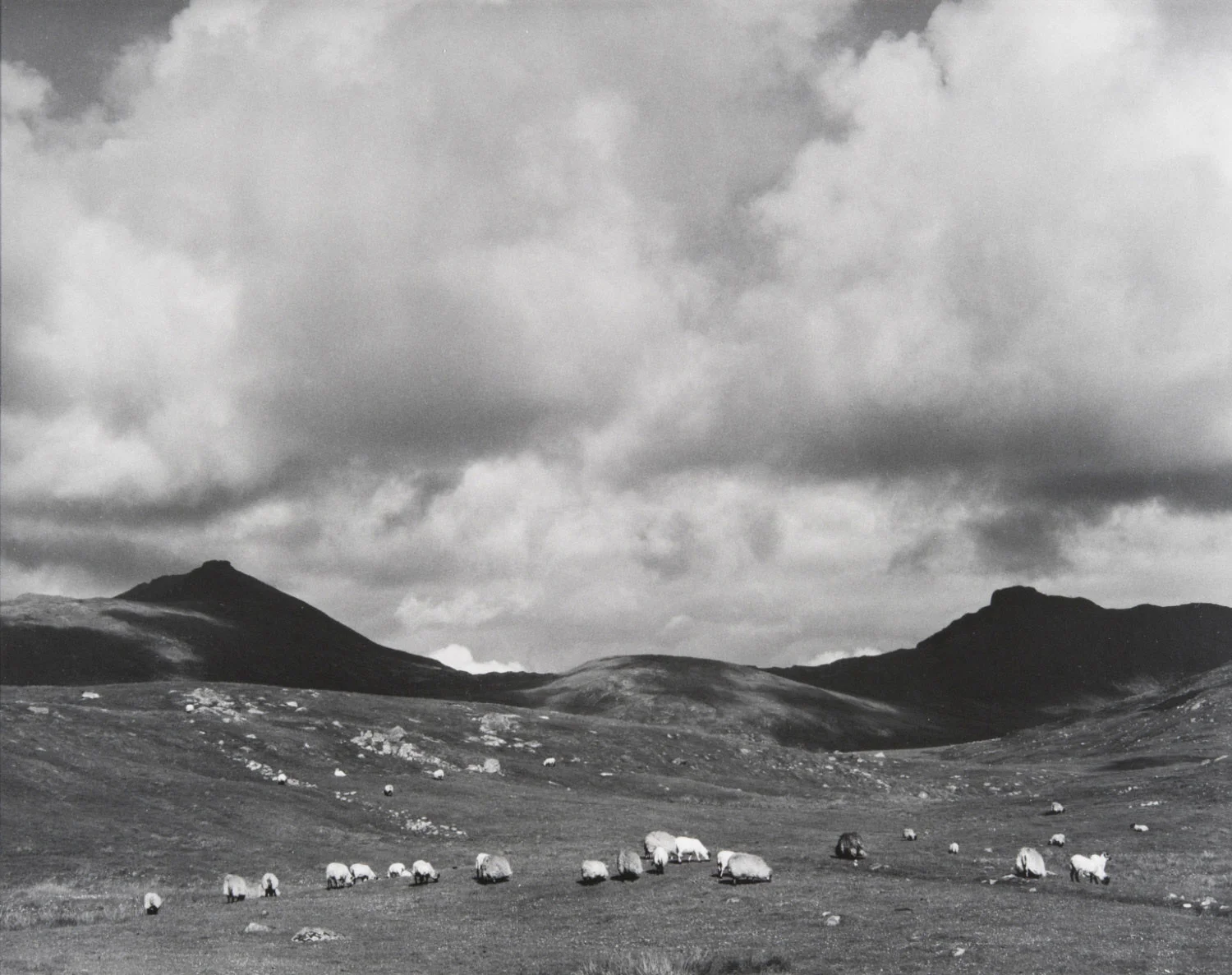
Sheep on the moor. Paul Strand, 1963
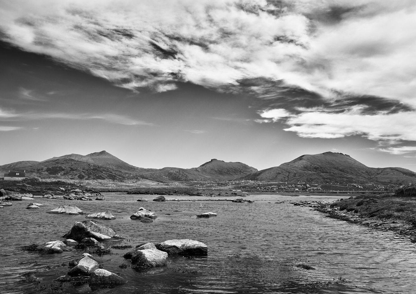
I had run out of time to find this location on my first trip, despite having driven past it on several occasions, but before coming in 2017 I could estimate the rough position with relative ease on Google Earth and Streetview from the mountains’ profiles, and my host Jac at Bagh Alluin B&B confirmed I must be close. A few minutes driving between the Howmore River, the A865 nearby, and the minor road west to Howbeg (Tobha Beag), Peninerine (Peighinn nan Aoireann) and the French MacDonald site, soon revealed the exact place.
Sheep on the moor. Mark Farrington, 2017
A locked and bound gate barred my passage, but the hinges and fastenings were so rickety that I decided not to climb it; barbed wire prevented access over the fence and the modern telegraph pole would be central in the frame. The exact position is slightly closer in to the field and to the left of where mine was taken (from over the gate). Considering the alignment of the rocks, grassy hillocks and mountains Strand's tripod probably stood within the area of the modern fenced enclosure in the field shown in my image looking south along the main road.
This is at grid reference 768349 on OS Explorer 453. Click the images to open in a lightbox.


The arch of rocky outcrops in the midground of Strand’s image is clearly visible, and I was fortunate to have sheep, albeit under a cloudless sky. I have accordingly cropped a little lower, and left the telephone cables alone.
Click on the images to open in a Lightbox


I found pleasing shots of the two mountains from a little further west on the access road to the interesting French MacDonald site, and also from water level beside the road bridge of the farm track across the Howmore River at grid reference 754363 on OS Explorer 453.
Some time it would be good to return to the area to catch early morning or late evening light and interesting clouds, especially from the Howmore River, where the rocks in the water provide foreground interest. The 13th century chapels at Tobha Mhor are well worth a visit.
Here are some links to resources on the French MacDonald:
https://en.wikipedia.org/wiki/Jacques_MacDonald
http://news.bbc.co.uk/1/hi/scotland/highlands_and_islands/6766507.stm
http://www.visitouterhebrides.co.uk/see-and-do/location-t-howbeg-bonnie-prince-charlie-trail-p542181
http://www.napoleon-series.org/reviews/memoirs/c_MacDonald.html